Introducing

Ocean Guard

Maritime Intelligence for Humanitarian Operations

Scroll
Overview

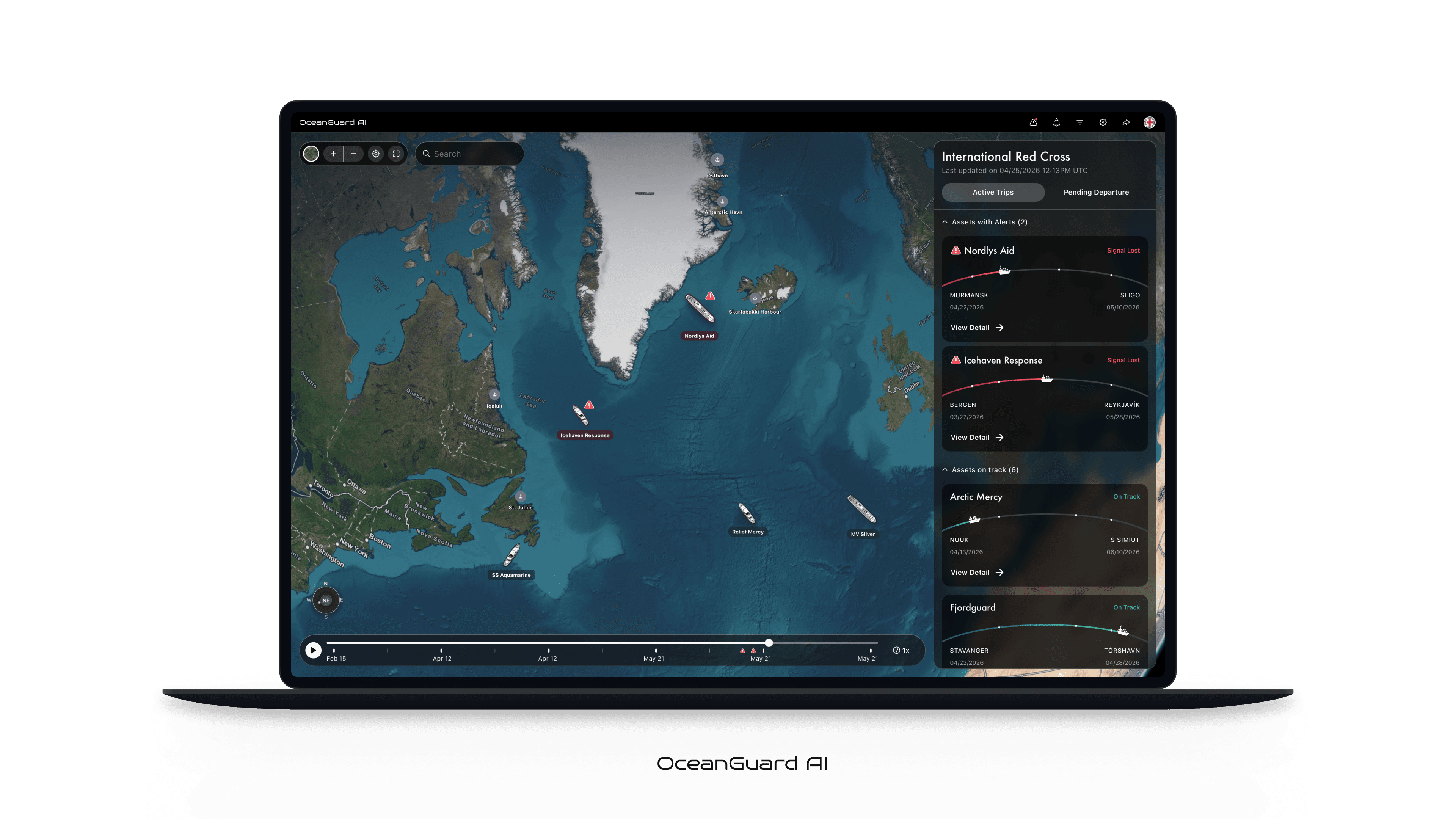
Ocean Guard AI is an AI-powered command center built for NGOs and humanitarian organizations managing maritime fleets under conditions of uncertainty, urgency, and high human stakes.

When a vessel goes dark, fragmented tools slow response. Ocean Guard replaces this with a unified, real-time map where every ship is visible alongside live status, alerts, and operational context. A temporal scrubber enables operators to instantly rewind and review past states, turning investigation into a direct, intuitive action.

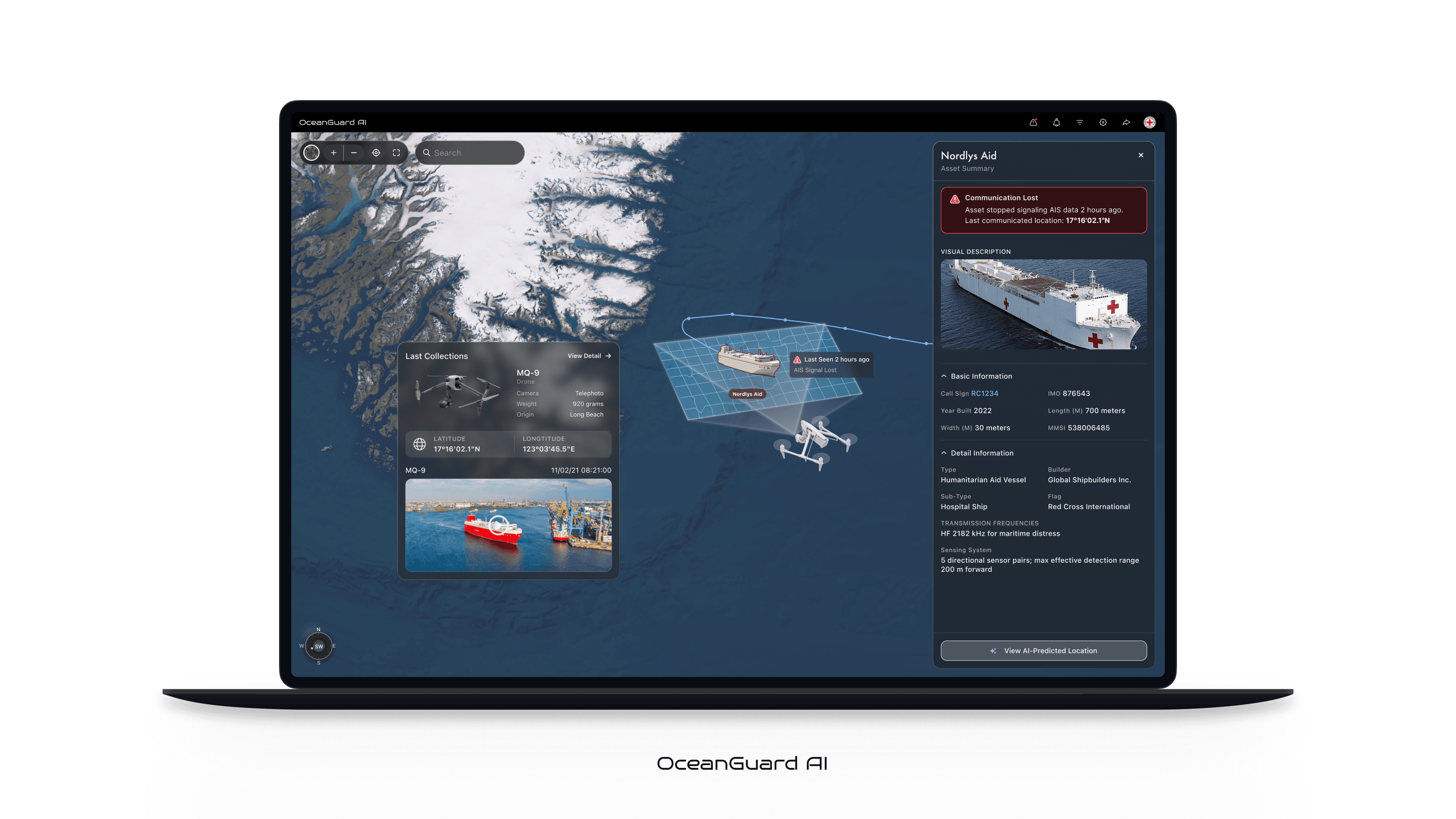
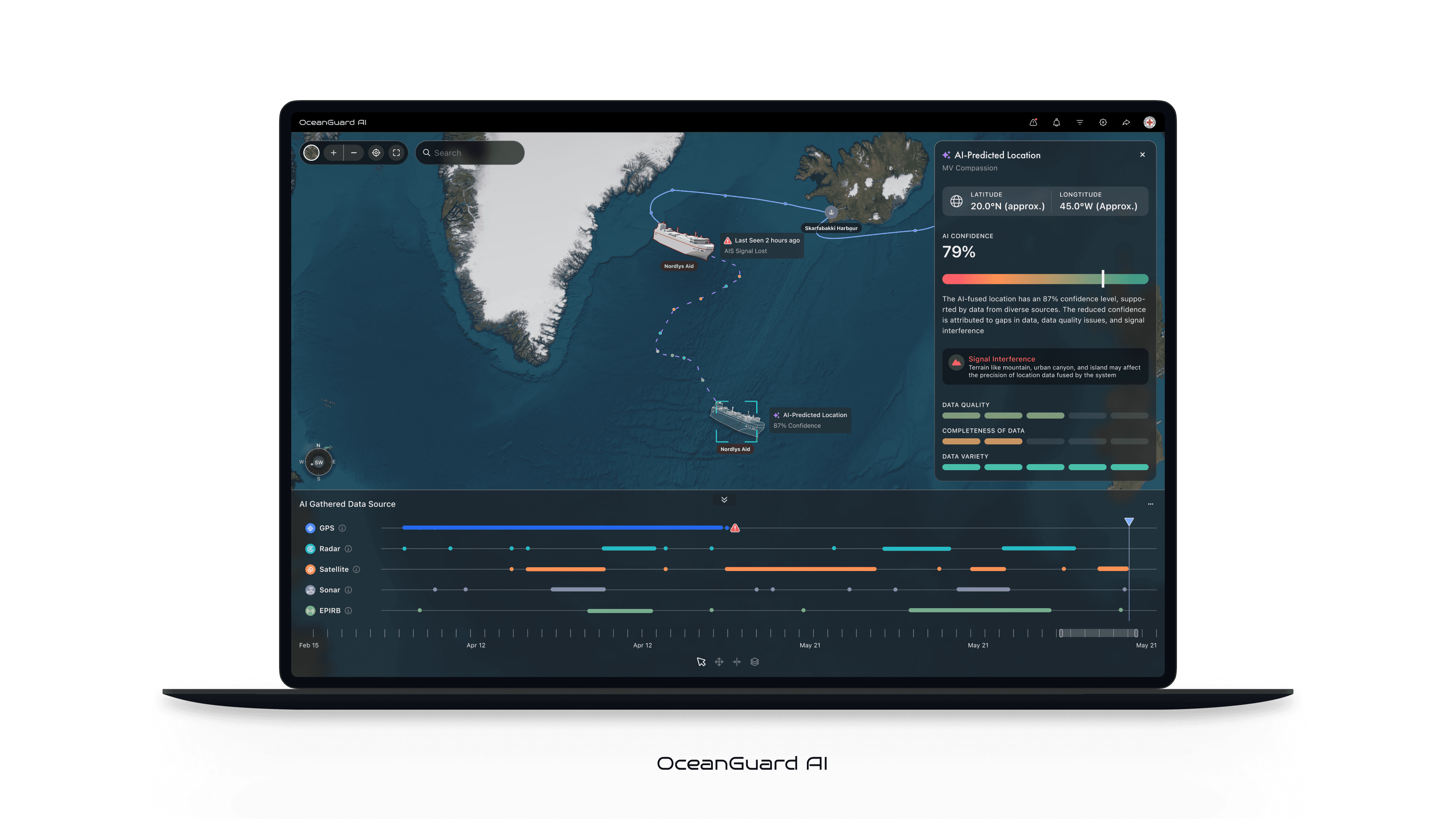
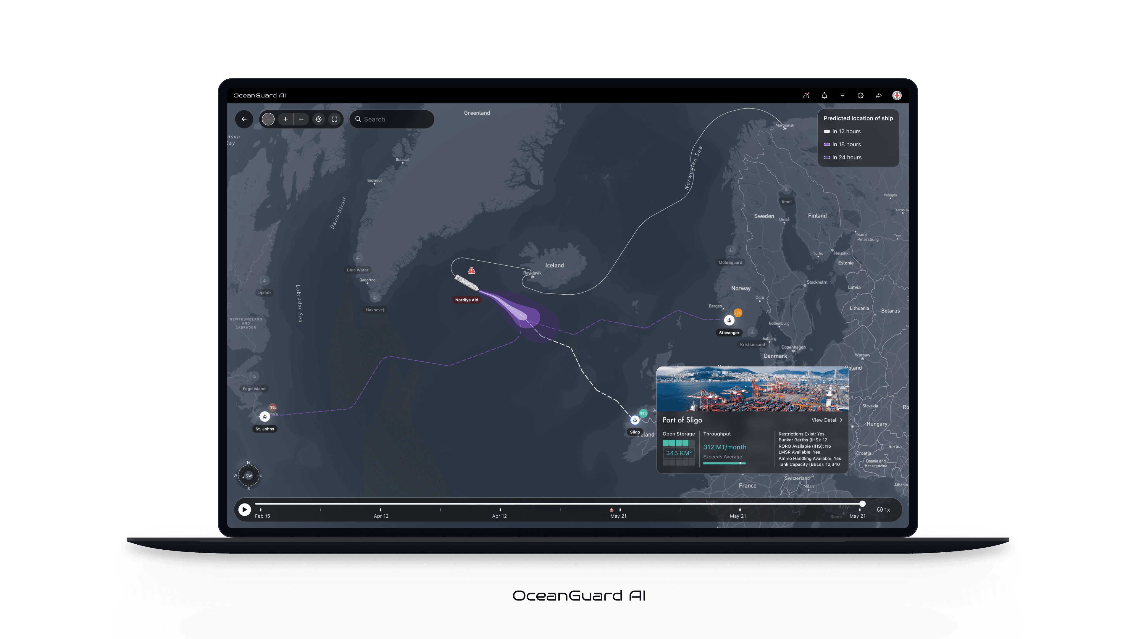
At its core is advanced AI technology that fuses GPS, radar, satellite imagery, sonar, and drone data into a continuously updated situational model. The system refines vessel positioning in real time and projects probable trajectories across multiple time horizons, identifying reachable ports and assigning arrival probabilities—turning insight into action within seconds.

Designed for clarity under pressure, Ocean Guard reduces cognitive load and enables faster, more confident decisions. Built for humanitarian response at sea, it helps ensure aid reaches those in need and operations remain resilient.

Capabilities
01Unified Command

All fleet activity, one surface

Ocean Guard consolidates all fleet operations into a single, unified interface. Every vessel is visualized on a live map, enriched with real-time status, alerts, and contextual data. By eliminating fragmented systems, operators gain immediate insights without switching tools—reducing response time and cognitive load in critical moments.

OceanGuard unified fleet command interface
02Asset Recovery

Lost vessel detail

When a vessel goes dark, Ocean Guard surfaces its last known collection point directly on the map. A side panel provides key asset details—signal history and asset information—organized for quick understanding. This keeps critical context anchored in place, turning uncertainty into a clear investigative starting point.

OceanGuard vessel location and recovery interface
03Track Analysis

AI Track Analysis

Powered by advanced AI, Ocean Guard fuses GPS, radar, satellite imagery, sonar, and drone inputs into a continuously evolving situational model. The system identifies patterns, anomalies, and probable vessel behavior, enabling operators to understand not just where a vessel is—but what is likely happening.

OceanGuard AI track analysis and prediction
04Movement Forecast

Forecast future movement

Ocean Guard extends awareness into the future through predictive modeling. AI projects probable vessel trajectories across multiple time horizons, highlighting reachable ports and assigning arrival probabilities. These forecasts allow operators to rapidly form response strategies, turning uncertainty into actionable planning within seconds.

OceanGuard movement forecast and port intelligence